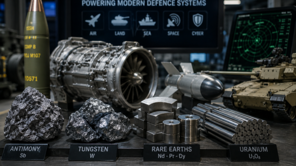

Cosa Resources Corp. (TSXV: COSA) (OTCQB: COSAF) (FSE: SSKU) acquired the Cosmo uranium property to strengthen its portfolio of under-explored uranium projects in the Athabasca Basin.
The company announced the acquisition on Friday. The eastern Athabasca Basin holds 12 claims of Cosmo, covering 9,308 hectares. It sits 36 kilometers west of the Hurricane Deposit and 58 kilometers north of the Cigar Lake Mine. Provincial Highway 905 lies within seven kilometers of the Property, and the property hosts a network of trails and a provincial powerline passing through it.
The curvilinear magnetic low strike length spans 18 kilometers within Cosmo, indicating favourable metasediments.
Historical exploration activities were confined to a 1979 lake sediment sampling program and a 2007 airborne geophysical survey.
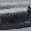
Although no drilling has been conducted within the property itself, historical drilling conducted 13 to 25 kilometers along strike to the east encountered several intervals of weak uranium mineralization. Notably, drill hole BL-14-20 (549.9 – 551.1 m) intersected 0.20 percent U3O8 over 1.2 meters.
“With the successful acquisition of Cosmo, we continue to strengthen our portfolio of prospective and under-explored uranium projects in the Athabasca Basin,” said Keith Bodnarchuk, president and CEO.
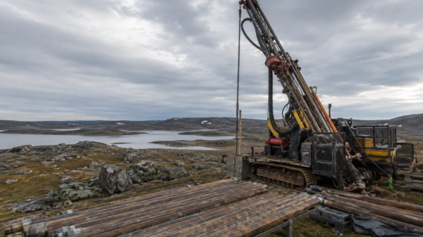
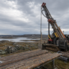
Cosa plans to conduct initial work, which will involve electromagnetic (EM) surveying to define target areas within the property. Positive results would prompt aggressive follow-up work, including ground EM and drilling, given the ease of access and proximity to known mineralization along strike.
Despite unseasonably warm conditions, Cosa is currently mobilizing drilling equipment, supplies, and personnel to its Ursa Project, and the process is nearing completion. Cosa will begin drilling immediately after.
Read more: ATHA Energy adds seasoned exploration and corporate affairs managers to its team
Read more: ATHA Energy appoints highly-experienced technical advisor into its leadership roster
Electromagnetic surveying a big part of uranium exploration
Electromagnetic surveying plays a necessary role in uranium exploration and production. Producers like Cosa Resources commonly use EM surveys to detect and delineate conductive bodies within the Earth’s subsurface. In uranium exploration, EM surveys are particularly valuable for identifying potential uranium mineralization zones. Uranium deposits often exhibit conductive properties due to the presence of associated alteration minerals or graphite.
EM surveys help to identify geological structures, such as fault zones or alteration zones, which are often associated with uranium mineralization. By detecting these conductive anomalies, exploration teams can prioritize drilling targets more effectively, reducing exploration costs and increasing the chances of discovering economically viable uranium deposits.
Furthermore, in uranium production, companies often employ EM surveys for monitoring and mapping the underground environment, helping to optimize mining operations and ensure the efficient extraction of uranium ores.
Earlier this week, Stallion Uranium Corp. (TSXV: STUD) (OTCQB: STLNF) released results from the largest-ever airborne geophysical survey in the southwestern section of the Athabasca Basin.
The junior explorer covered the entire area of its joint venture project property with ATHA Energy Corp. (CSE: SASK) (FRA: X5U) (OTCQB: SASKF). The survey spanned 2,200 square kilometers.
In the past year, ATHA has identified 28 prospective targets across its exploration targets coinciding with uranium mineralization. The company had tested 17 of 28 across its 3.8 million acre exploration portfolio by the end of last month.
ATHA Energy Corp. is a sponsor of Mugglehead news coverage