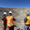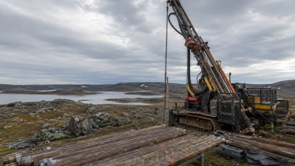

Cosa Resources Corp. (CSE: COSA) hired Expert Geophysics Limited to conduct airborne surveys at its Ursa and Orion projects in Saskatchewan’s Athabasca Basin in search of new uranium deposits.
The planned MT survey aims to detect basement EM conductors and anomalous resistivity zones in the sandstone formation. The survey will cover a total of 2,900 line-kilometres to ensure comprehensive coverage across the Ursa and Orion properties.
MobileMT is an advanced helicopter-borne magnetotelluric (MT) survey system used to detect electromagnetic (EM) conductors in zones of unusual resistivity in the sandstone. With the ability to accurately map resistivity contrasts, the MobileMT system can provide valuable insights into the subsurface at depths exceeding 1000 metres. Notably, previous MT surveys have successfully identified basement conductors and alteration zones in the sandstone formations of prominent uranium deposits like McArthur River and Shea Creek.
By utilizing a modern geophysical dataset, the survey will enable the identification and prioritization of specific areas of interest that require further investigation.
“Ursa and Orion contain nearly 75 kilometres of combined strike length of highly underexplored magnetic lows hosting EM conductors,” said Andy Carmichael, VP of exploration.
“With such a large area to explore, MobileMT results will evaluate prospective corridors in their entirety to identify and prioritize key areas for follow-up.”
In summer 2023, a MT survey is scheduled to cover approximately 2,900 line-kilometres at the Ursa and Orion properties. Around 90 per cent of the survey work will be conducted at Ursa.
The planned survey provides a cost-effective and efficient approach to assess the underexplored 75-kilometre prospective strike length across the properties. By prioritizing target areas, it accelerates exploration efforts. Surveying will begin in late June and is expected to be completed in approximately three weeks.
Surveying is planned to begin in late June and will take approximately three weeks to complete.

Electromagnetic conductor trends at Ursa. Image via Cosa Resources.
Read more: NevGold issues $1.5M in shares to GoldMining Inc. for Nutmeg Mountain project
Read more: NevGold’s oxide gold drill program in Nevada finds positive results
Historical geophysical coverage a patchwork of surveys
Cosa Resources is a mineral exploration company headquartered in Vancouver, BC, Canada.
The company’s primary focus is on exploring its uranium and copper properties located in northern Saskatchewan. Cosa Resources holds a portfolio of six uranium exploration properties: Ursa, Orion, Castor, Charcoal, Helios, and Astro.
These properties collectively cover an area of 140,677 hectares and are situated in the eastern and northern regions of the Athabasca Basin, known for their significant mineral potential in uranium exploration.
At Ursa, the existing geophysical coverage consists of a patchwork of historical airborne and ground surveys conducted primarily between 1978 and 2008. Although the historical airborne electromagnetic (EM) surveys confirmed the presence of basement-hosted EM conductors, their resolution was insufficient for meaningful interpretation.
Similarly, the historical ground EM surveys indicated the presence of basement EM conductors, but follow-up drilling seldom intersected conductive basement units.
Despite the ineffective targeting, the limited historical drilling did encounter structurally disrupted sandstone and basement, hydrothermal alteration, and minor mineralization. Notably, drill holes CR-03 and CR-08 intersected up to 0.05 per cent and 0.18 per cent U3O8 uranium in the basement, respectively, which have not been adequately investigated further (see Figure 2).
The upcoming MobileMT survey represents the first instance of this section of the Cable Bay Shear Zone (CBSZ) being covered by an airborne system capable of imaging the basement well beyond the unconformity. Cosa, the organization behind the survey, expects that the results will significantly enhance the understanding of this regional-scale structural corridor.
Ursa’s 65-kilometre section of the CBSZ offers a highly prospective geological setting that remains significantly underexplored. It serves as a geological analogue to the settings that underpin major current and past-producing uranium mines in the eastern Athabasca Basin. The estimated depth to the unconformity in the project area ranges between 600 and 1000 metres.
Orion is situated 15 kilometres northeast of Ursa and encompasses an eight-kilometre stretch of a curvilinear zone exhibiting low magnetic susceptibility. Within this zone, historical electromagnetic conductors are observed to overlay a magnetic high, suggesting the presence of favorable structural complexity.
Despite this promising indication, no historical drilling has been conducted on the project to date. The estimated depth to the unconformity in the area ranges between 750 and 900 metres, drawing from drilling data obtained from neighboring sites.
Cosa Resources shares dipped 2.4 per cent to trade at $0.41 on the Canadian Securities Exchange.
Follow Joseph Morton on Twitter
joseph@mugglehead.com